Reading the Mountain: A First-Timer's Guide to Understanding Rocky Mountain Geology
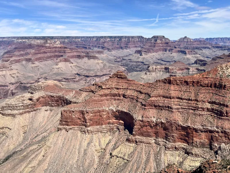
Stand at the base of a Rocky Mountain canyon—Red Rocks outside Denver, the Black Canyon of the Gunnison, or the Wind River Range in Wyoming—and you're looking at a timeline stretching back over a billion years. Every layer of rock, every jagged ridge, every smooth river-polished boulder is a sentence in one of Earth's longest stories. The problem is most of us never learned to read it.
That's what this guide is for. You don't need a geology degree or a rock hammer. You just need to know what to look for—and once you do, the Rockies will never look quite the same again.
The Big Picture: How the Rockies Actually Formed
Let's start with the basics, because the origin story of the Rocky Mountains is genuinely wild.
The range we see today is largely the result of a major tectonic event called the Laramide Orogeny, which kicked off roughly 70 to 80 million years ago and wrapped up around 55 million years ago. Unlike many mountain ranges that form where two plates collide head-on, the Rockies were pushed up by a subducting oceanic plate that dove at an unusually shallow angle beneath the North American continent—essentially shoving the crust upward from far inland rather than at the coast.
But here's the twist: the rocks that were shoved upward weren't new. They were ancient—in some cases, Precambrian basement rocks that are 1.7 billion years old. When you touch the dark, sparkly gneiss and schist exposed at the core of peaks like Longs Peak in Colorado or the Tetons in Wyoming, you're literally touching some of the oldest material on the continent's surface.
On top of those ancient cores, younger sedimentary layers—limestone, sandstone, shale—were laid down over hundreds of millions of years when shallow seas covered much of the interior West. The Rockies' dramatic uplifting tilted and exposed those layers, which is why you often see dramatically angled rock strata on the flanks of mountains rather than flat horizontal beds.
What to Look For on the Trail
The Dark Basement Rocks
When you spot dark gray or black rocks with a shiny, almost metallic texture and a swirling pattern that looks almost like wood grain, you're likely looking at Precambrian metamorphic rocks—gneiss and schist. These form the heart of many Rockies peaks. They were once sedimentary or igneous rocks that were transformed by intense heat and pressure deep within the earth, then brought to the surface by tectonic uplift.
In Rocky Mountain National Park, the Trail Ridge Road cuts through terrain where these ancient basement rocks are exposed right at the surface. It's one of the easiest places in the country to see billion-year-old material up close without any technical effort.
Sedimentary Stripes
Notice the colorful horizontal or tilted bands on canyon walls and foothills? Those are sedimentary layers—limestone, sandstone, and shale deposited in ancient seas, rivers, and floodplains. The famous tilted red sandstone slabs at Garden of the Gods near Colorado Springs are a textbook example: originally horizontal layers of Permian-age sandstone that were tilted nearly vertical when the Rockies rose.
Color is a useful clue. Red and orange tones usually indicate iron-rich sandstone. Gray or tan layers are often limestone, which typically formed in marine environments. Dark gray to black layers can indicate shale, sometimes rich in organic material from ancient swamps or sea floors.
Glacier Signatures
If you're hiking in a broad, flat-bottomed valley with steep walls on either side—what geologists call a U-shaped valley—you're walking through the legacy of a glacier. River erosion carves V-shaped valleys; glaciers carve U-shaped ones. Rocky Mountain National Park, the Beartooth Range in Montana, and the Tetons are full of them.
Look also for polished, striated rock surfaces—smooth patches on bedrock with parallel scratches running in one direction. Those scratches were made by rocks embedded in the base of a moving glacier, dragged across the surface like sandpaper. Find a striated surface and you know exactly which direction the ice was flowing.
Boulders sitting in places that seem to make no geological sense—a huge granite block sitting alone in a meadow, far from any cliff—are called glacial erratics. They were carried by glaciers and dropped when the ice melted. Spotting them becomes a kind of game once you know what they are.
How to Read a Summit's Shape
The silhouette of a peak can tell you a lot about how it was shaped.
Pointed, pyramid-shaped peaks (called horns or arêtes) were sculpted by glaciers eroding from multiple sides simultaneously. The Maroon Bells near Aspen are a stunning example—those sharp, dramatic profiles are entirely glacial in origin.
Rounded, dome-shaped summits often indicate that glaciers rode over the peak rather than carving around it, or that the peak was above the glacial line and shaped primarily by freeze-thaw weathering over millions of years.
Flat-topped mesas and plateaus in the southern Rockies and adjacent plateau country tell a story of horizontal sedimentary layers that resisted erosion better than surrounding rock. Grand Mesa in Colorado—the world's largest flat-topped mountain—is a classic example.
Easy Geology Stops Worth Putting on Your Itinerary
You don't have to go deep into the backcountry to get a solid geology lesson. These spots are accessible, well-interpreted, and genuinely awe-inspiring:
- Dinosaur National Monument, Colorado/Utah border — Exposed dinosaur fossils in situ, plus incredible canyon geology. You can see the bones still embedded in the rock wall.
- Black Canyon of the Gunnison, Colorado — Some of the oldest exposed rock in the Rockies, with dramatic 2,700-foot walls of dark Precambrian gneiss and schist.
- Red Rocks Amphitheatre, Morrison, Colorado — Tilted Permian sandstone layers explained beautifully by on-site interpretive signs, and you might catch a concert while you're at it.
- Beartooth Highway, Montana/Wyoming — The drive itself is a geology tour, cutting through ancient Precambrian terrain with stunning views of glaciated peaks.
A New Way to See the Mountains
Geology isn't just an academic exercise—it's a different kind of trail companion. When you understand that the canyon you're descending was carved by a glacier 15,000 years ago, or that the limestone beneath your boots once sat on the floor of a warm inland sea full of marine life, the hike becomes something bigger than exercise or scenery.
The Rockies are a living textbook. Bring a sense of curiosity, look at the rocks with fresh eyes, and you'll find that every trail has a second story running beneath the one your boots are walking.